Rizal Philippines | October 4, 2014
From Wikipedia on Floodway

The floodgates
It has been a week since I got the pictures for this, but I am always postponing making the post because I believe this is a rather challenging and difficult study. However we must confront this issue This is politically unpalatable. DEaling with vote rich settlement is a no no, But not doing so, not confronting reality gets the problem buried. In the meantime, we suffer the consequences: frequent flooding, loss of property, loss of lives. etc
Background:
Manggahan floodway was built in 1986 at a cost of Php 1.1 billion. Marikina river flood water is diverted to the Manggahan spillway, instead of going to Pasig River, and MM, and to prevent flooding in Malacanang. The water goes to Laguna Lake where it is impounded and released later to Manila bay via Napindan channel and Pasig River. Because of complication brought by low and high tide and currents, and the 12 km distance to Manila bay, the effective hours of draining the LLake is effectively only 6 hours a day. Thus, draining the floodwaters from Laguna lake takes 3 to 6 months.
It is 10 km long


Several shorter outfall to drain LL were proposed:
1. One via Paranaque. The ROW cost here however is staggering.
2, The other in Sta Maria Laguna
This should be fast tracked as prolonged floods at Laguna lake cause discomfort among settlers at Laguna lake coastal towns.. They are more than MM residents
The floodway is between 260 to 100 meters wide and 10 meters deep, with sloped embankments with a 20 meters base on both banks. There are roads on top of the banks: the East and West Banks
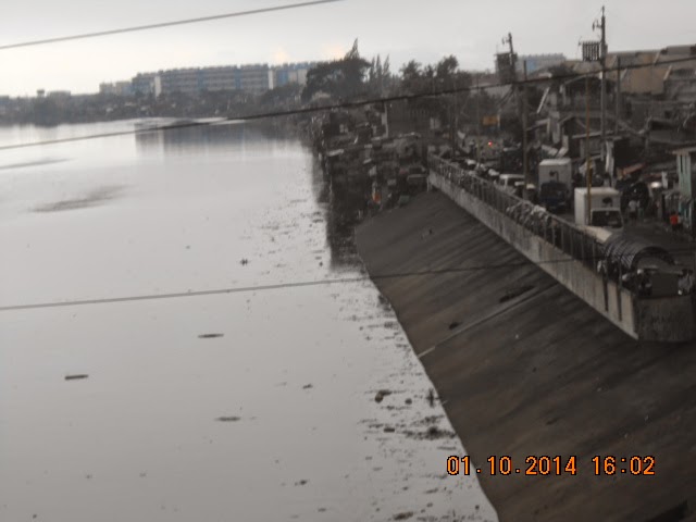
Informal settlers flood both banks
However there are at least 4,000 families who are illegal settlers populating on both sides of Manggahan floodway who have made the waterway as garbage disposal and sewer effectively making the floodway shallower. Some reported the floodway to be only 3 to 4 meters deep at some portion
Some settlers there include Barangay (one in Pasig) and TAytay and govt properties: barangay hall, swimming pool, sports facilities occupy portion of the floodway.
Lessened drain rate
The floodway can effectively drain floodwaters at the rate of 2,400 cubic meters per second. But at its current state, its efficiency could be as lower by 20%
or about 1,900 cubic meters per second.
Let us try to estimate the effect:
In an area of 10,00 square km with a rainfall of 255 mm over a 12 hour period,
Total flood volume: 25,000,000 cubic meters
1. drain time at 2,400 cu meters per second.
= 10,416 seconds 7.23 hours
2. drain time at 80% efficiency
= 13,020 seconds 9.04 hours
Of course the catchment area is more than 10 square km but you can see the effect of obstruction, encroachment on the efficiency of the floodway, and how they affect its function.


Encroachments:
At the west bank
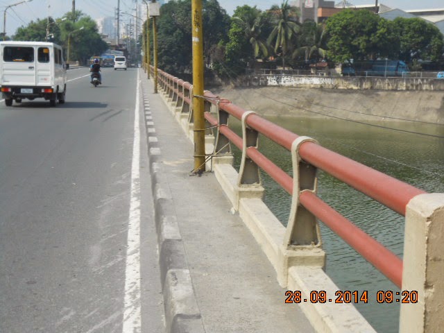
As seen from Javier bridge


At the east bank


Near Highway 2,000


